New TTC fantasy map is every planned line that was never built
Have you ever wondered what Toronto's transit system would look like if every new line that's ever been approved had actually been built?
You're not alone.
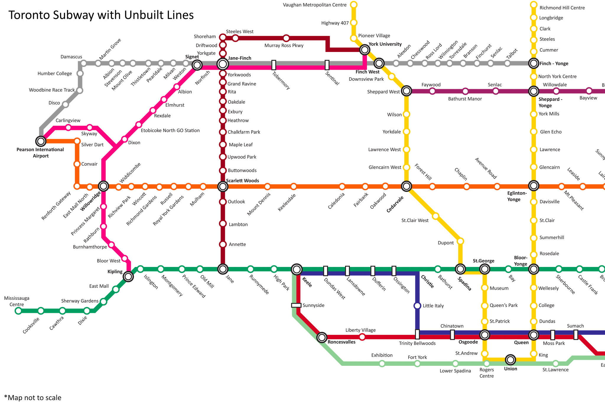
A local urban planning buff who goes by the handle JSF-1 on Reddit shared a TTC fantasy map this week that purports to include "almost al the lines that are planned, and were never built."
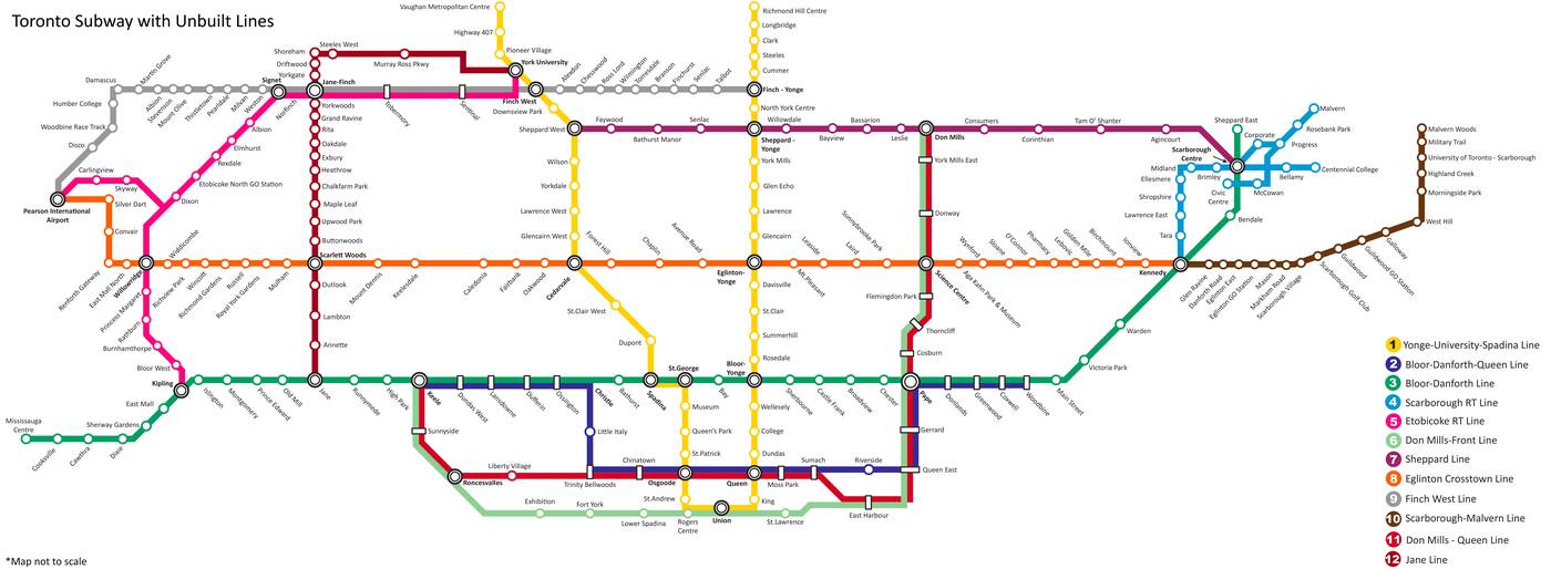
Toronto Subway map with unbuilt transit lines by JSF-1 on Reddit via Imgur. Click to embiggen.
So, what exactly is going on here?
JSF-1 was kind enough to answer lots of questions in the Reddit thread about his map what it represents.
Lines 1,2,3,6,7 and 11 were all planned as subway lines — and some of them do exist, at least in part, most notably the Yonge-University, Bloor-Danforth and Sheppard Lines.
The beautiful Don Mills-Queen Line and Bloor-Danforth-Queen Line seen on JSF-1's map are still but a dream for the commuters of this city. Try as they might, the city has never quite been able to make a Queen Subway Line happen.
Six other lines shown on the map — 4,5,8,9,10, and 12 — were planned as Light Rail Transit lines.
Plans for number 10, the Scarborough-Malvern Line, were famously scrapped by former Mayor Rob Ford in 2010, but later revived as the yet-to-be-built (or funded) Eglinton East.
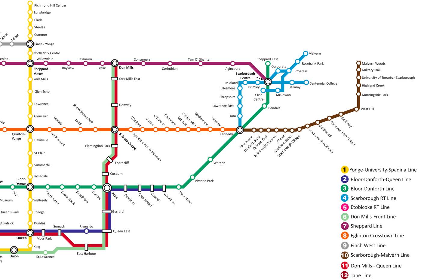
Toronto's latest transit fantasy map includes 12 different lines, 6 of which are planned subways and 6 of which are planned LRTs.
"What in the f--k is happening at Scarborough Centre Station?" asked one Redditor, referring to the unrecognizable jumble of blue at the far right of JSF-1's map.
"The original plan for the SRT in the 70's/80's was actually an LRT and a few alignments were proposed for the line," wrote the designer. "Obviously in the end only 1 alignment would be (and was) chosen."
The entire thread, and in fact most everything that JSF-1 has posted is quite educational, and fascinating if you're into urban planning and transit.
Apparently the idea of a running a subway under Queen Street dates back all the way to 1910. That's 108 years we've had to build what could serve as a major downtown relief line — and, as this map shows, it's still the stuff of fantasy.
Latest Videos
Latest Videos
Join the conversation Load comments